Showing posts with label NPS. Show all posts

Saturday, April 11, 2026

60-60-60: “Best of” list

Favorites and Best Of list:

As we traveled across the country, some elements we encountered over and over.  So then we had to pick the “Best”.  Here is the last wrap up of the 60-60-60 trip!


- Most surprising state on the trip

          Ruth - Nebraska, Cheryl - Idaho

- Favorite Trees - Redwood National and State Parks, CA

- Favorite Rocks - Arches National Park, UT

- Favorite Scenic drive - Beartooth Scenic Byway, MT

- Favorite Crops - winter wheat and rapeseed

- Favorite Lava - Craters of the Moon National Monument and Preserve, ID

- Favorite Indian Trading Post - Fort Union Trading Post NHS, ND

- Favorite Fort - 

           Ruth - Fort Larned NHS, KS

           Cheryl- Fort Smith NHS, OK/AR

- Favorite Walk - John Day Fossil Beds NM, OR - blue cliffs

- Favorite Bird - orange headed grosbeak, in Rose Creek Preserve outside Pullman, WA

- Favorite Animal - 

        large - moose in Rocky Mountain NP, CO & Idaho

        Small - marmot - in Beartooth, MT

- Favorite Ruins - Aztec Ruins NHS, NM

- Favorite Mounds - Hopewell Culture NHP, OH

- Favorite Volcano - Newberry Volcano, LaPine,OR 

- Favorite Civil rights - Medgar & Myrlie Evers Home NM, MS

- Favorite Native American site - Nez Perce NHP, ID

- Favorite Ice Age - Palouse Falls State Park Heritage Site, WA

- Favorite Historic or Scenic trail - Oregon National Historic Trail, ID, KS, NE, OR, WA, WY

- Favorite Visitor Center - California Trail Center BLM site, NV

 - second place, Wyoming state visitors center

- Favorite Park Ranger - Leon at Fort Union Trading Post, ND

- Favorite National Park overall - Theodore Roosevelt NP, ND

- Favorite Beach - Olympic NP, WA

- Favorite Sand Dunes - Great Sand Dunes NP & Preserve, CO

- Favorite Civil War site - Wilson's Creek NB, MO

- Favorite Quilt - Lincoln Log Cabin State Park, IL

- Favorite Living History - Nicodemus NHS, KS

- Favorite Engineering site - Gateway Arch NP, MO, and Golden Spike Tower, NE   

- Favorite Mural - Cuba, MO

- Favorite Roadside art - Bronze statues, Raymond, WA

- Favorite BnB - Clinton, OK

- Favorite Hotel - Econolodge, all over

- Favorite Restaurant Meal - Belle Fourche, SD Mexican dinner

- Favorite Fossils - 

    Animals - Agate Fossil Beds NM, NE

    Trees and insects - Florissant Fossil Beds NM (and Night sky, CO

- Favorite Battlefield - Little Big Horn NM, MT

- Favorite Rainbow - driving from Wy to Scotts Bluff NM, NE


Wednesday, March 25, 2026

60-60-60 - The Forces of Wind and Water

WIND and WATER


While volcanoes and earthquakes throw up new features on the landscape, wind and water mold rock into fantastic shapes to create canyons, mesas, hoodoos, buttes, spires, and arches from the top down.  

Badlands NP of SD and Theodore Roosevelt NP in ND are prime examples, where erosion has created many of these formations in spectacular colors. Standing on the prairies and looking down into the vast expanse of layered rock formations, and realizing the red, orange, yellow and grey layers were once swamps, rivers, forests, or seas that produced different minerals and fossils, left us in awe of the  millions of years of changing climates and ecosystems that came before us and how very tiny our current existence is in geologic time. They are also astoundingly beautiful and another reminder of what currently exists beneath our feet.


Canyonlands NP, UT is another impressive example of wind and water creating  beautiful vistas of mesas buttes and spires. One interesting phenomena here was the sheer cliff faces covered with “desert varnish,” a black film of iron and manganese oxide and dust. We stopped at Newspaper Rock to view the many petroglyphs, some over 2,000 years old, carved into the blackened surface of the rock by ancient peoples as well as a few more modern travelers.


Arches NP, UT, was another graphic demonstration of the power of wind and water to shape the landscape. While the Delicate Arch is the most famous feature, the volume and variety of formations, including arches, bridges, hoodoos, spires an many more,  are the real stars.  The Park is full of an amazing array of wonderful red rock formations, created primarily by wind.


Monument Valley Navajo Tribal Park, in Navajo Nation lands located within Arizona, is noted for the “monumental” sandstone buttes, some as much as 1000 feet high, that rise up out of the desert. Because they are  widely spaced, they are especially impressive. Even more impressive was the precipitous drive up and down the Moki Dugway, a narrow road that hugs the sheer edges of a huge butte, that was by far the best way to get to the Valley. (The word “moki” refers to a road that has been carved out of a hillside or cliff face.) Coming down the butte, we were treated to awesome views of the valley and the possibility of oblivion. Part of our experience was talking with Navajo women who were selling jewelry by the side of the road, and driving past many joggers who were re-enacting the scene from Forrest Gump, running along the same piece of road featured in the film.


One of the most consequential examples of erosion occurred during the Ice Age Floods when a glacier that had created a natural dam on the ancient Lake Missoula in Montana melted. A wall of water, ice and debris several hundred feet high rushed across eastern Washington, gouged out the Columbia River Gorge, and dumped into the Pacific Ocean. This happened many times over the millenia as the climate warmed and cooled. At Palouse Falls, part of the Ice Age Floods National Geologic Trail, the river cascades 200 feet over the sheer sides of the canyon and continues west. The place is significant because it is the last active year-round waterfall along the Ice Age Flood path. 


What is more impressive, though, is the huge Columbia River Gorge with its high basalt cliffs on both sides. The Gorge is about 80 miles long,from one to four miles wide (averaging 1.5 miles)and from the rim of the cliffs to the bottom of the river, about 4,000 feet deep in some places. Both the Falls and the Columbia Gorge are examples of the  dramatic result that can be produced by incomprehensible volume of water, ice and debris pummeling through the countryside.


The effects of water on the earth are not all above ground. Slower crafting of fantastic shapes was visible in the slow dripping of minerals and water in the caves of the  Black Hills in SD, where water eroded rock over millennia at Wind Cave and Jewel Cave. These two caves are among the longest in the world and are still being explored to document even greater length. Such exploration is not for the claustrophobic, as it involves crawling on your belly through very narrow passages. Both caves featured ranger-led tours that pointed out the various formations created by water flowing over and through rock.


We saw other examples of the erosion of rock over time by water and wind at Devils tower, WY,  


City of rocks, ID,  


Natural bridges, UT 


as well as the Oregon haystacks in the Pacific.


All these relentless forces of nature create much of the natural beauty of the earth, and inspire awe and appreciation for what we have and all that came before us. Each place inspired us to continue to seek more opportunities to learn more about our county and how it evolved over millions of years.

​60-60-60: Bones Rocks & Magma

Our cross country trip included a lot of parks celebrating the ancient history and geology of the United States. Below are a few of the highlights.


BONES


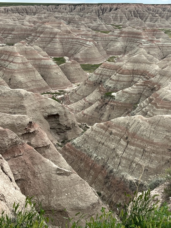
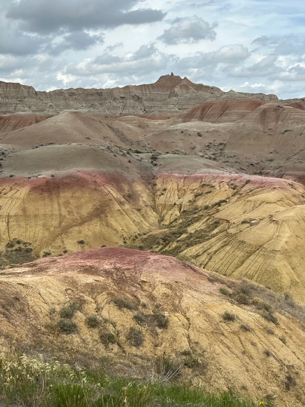
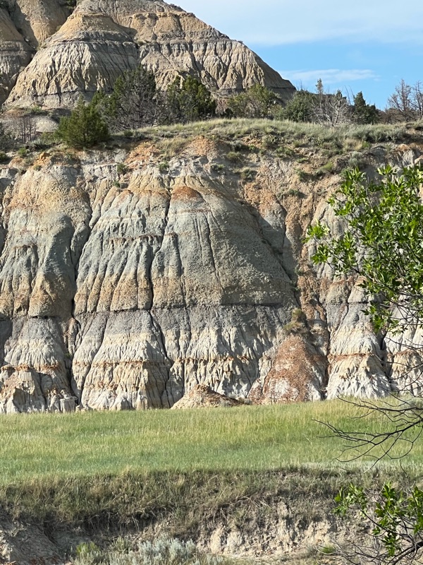
We visited six or more NPS sites where fossils were either the main attraction or at least part of the draw. We were impressed with how the Park Service made each site interesting by highlighting special features of the site. One of the things that struck us most profoundly is that huge areas of the US west of the Mississippi have massive fossil beds. This is partly because in ancient times the central part of the country was a vast inland sea. When marine animals died they sank to the bottom and were preserved in the low oxygen mud. There were also many volcanos and earthquakes as the Rocky Mountains pushed upwards burying ecosystems in volcanic ash and as mountains eroded they created layers of clay and silt deposits in the land below, where the effect of wind and water gradually exposes the fossils embedded in the rock for eons. 


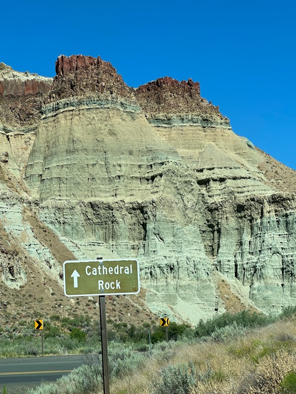
At Hagerman Fossil Beds NM, ID and John Day Fossil Beds NM in eastern OR, the role of paleontologists is mostly to wait for a big rain to expose new fossils. It was also interesting to learn about the conditions that led to different things being fossilized.


Cliffs with fossil layers at Hagerman


Early horses discovered at Hagerman


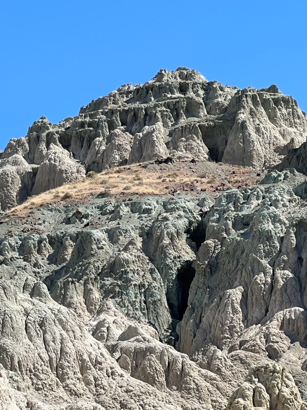
John Day blue and green clay cliffs full of fossils!


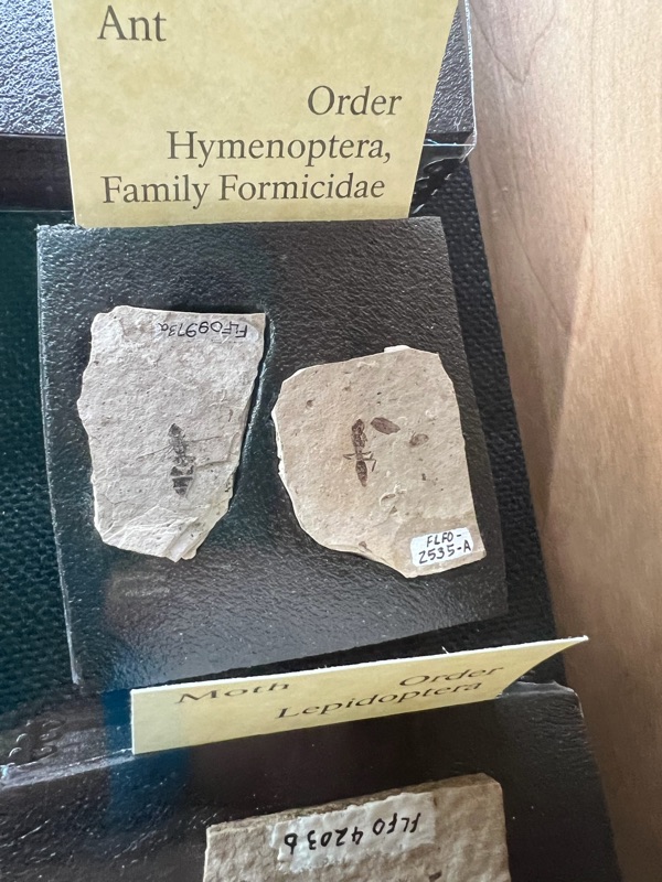
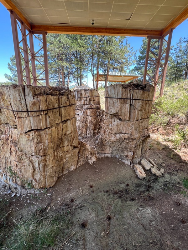
At Florissant Fossil Beds NM, CO, a muddy lake preserved so many insects that the site has drawn paleontologists from all over the world. Volcanic mudflows preserved Giant redwood stumps from 34 million years ago, but the tops of the trees were lost.


At Agate Fossil Beds NM in NE, a huge drought between 19 adn 21 million years ago brought carnivores and their prey to die by the same watering holes, trapping and preserving them in the mud (we especially liked the “Hell Pig”). 


A salt lick in Big Bone Lick, KY, brought a similar array of giant mammals to the same location creating layers of fossilized bones.


VOLCANOES


We knew that there would be a lot of volcanos on the West Coast, because we were already familiar with Mount Rainier, Mount Hood,  Mount St Helens and others, because they are famous for their iconic cones dominating the landscape. But we didn't know there are so many and so many different kinds of  volcanoes in the area. 


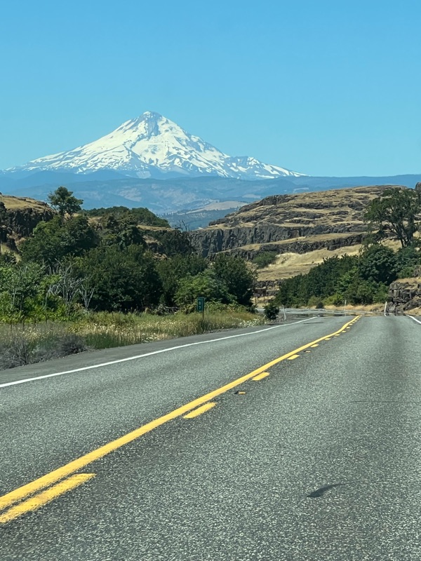
Mt Hood from the Colombia River Gorge


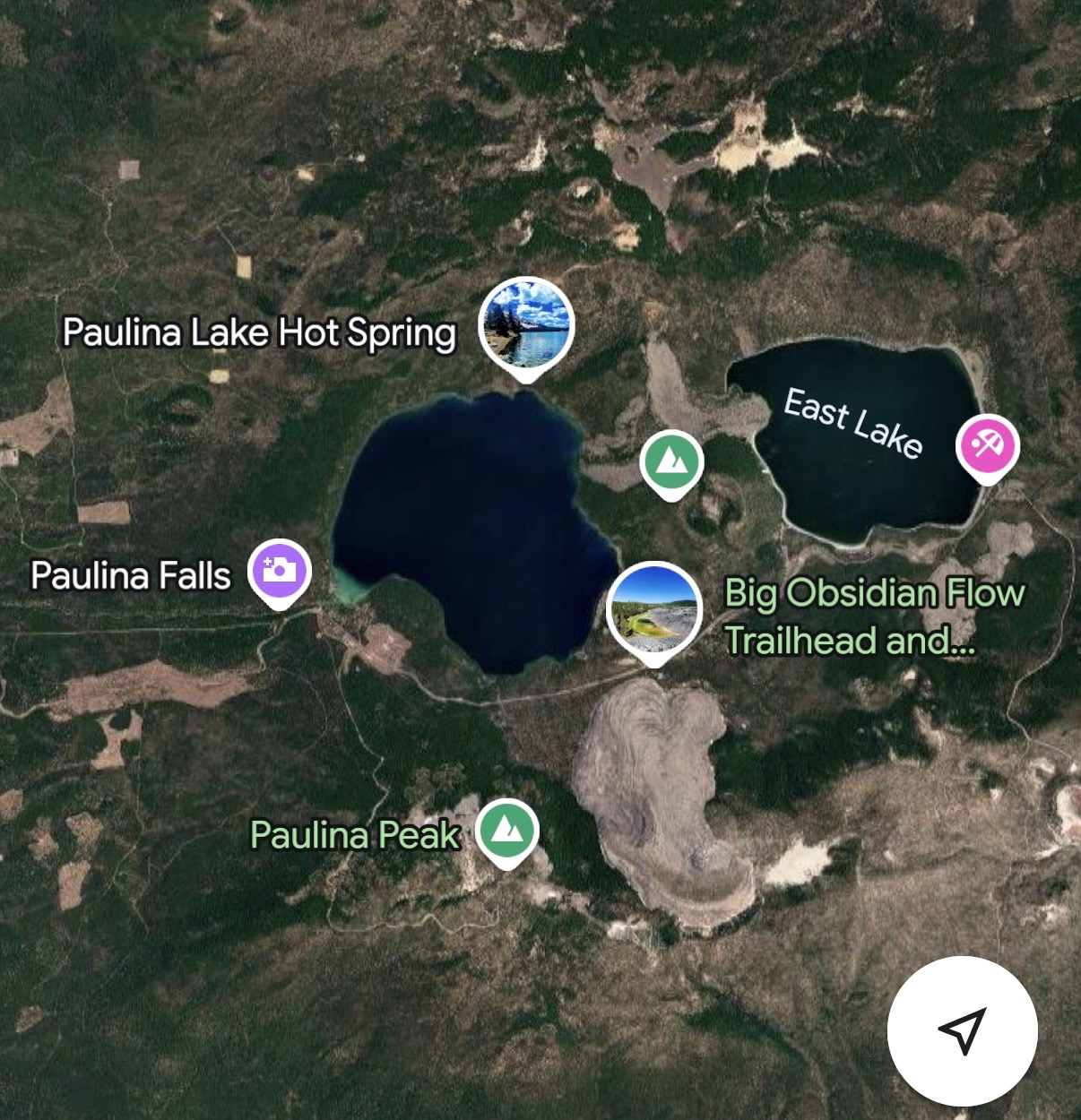
A rather precipitous drive up the side of a huge ash cone on the edge of the Newbury Volcano caldera near Bend, Oregon, was an opportunity to look down the results of eruptions of a huge shield volcano. From the top we looked down into the 17 square mile caldera containing 400 cinder cones and vents, two lakes and a large sea of obsidian. Later we had a close up view of the obsidian field which covers about a square mile of jagged black volcanic glass. 


Crater Lake,  Lassen and Lava Beds NPS sites each gave us a different perspective in the volcanic experience on the West Coast Volcano trail.  


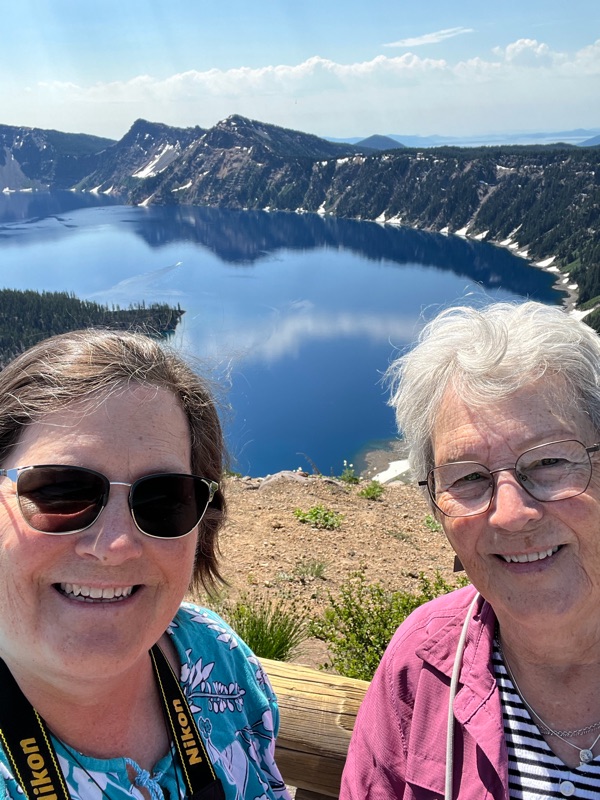
Crater Lake NP, OR, highlighted the ecological isolation that can be created by volcanic action. A huge stratovolcano, Mourt Mazama, erupted repeatedly over thousands of years, ever increasing its size. Finally, there was a mega eruption that caused the top of the volcano to blow up and then collapse under its own weight, creating a deep caldera in the middle of the remaining mountain. Centuries of rain and snowmelt filled the crater creating a very deep, beautiful crystal clear lake which is believed to be the cleanest water in the world.


In addition to lovely views, Lassen Volcanic NP, CA, had examples of all four types of volcanoes - plug (or lava) domes, cinder cones, shield volcanos  and stratovolcanos (composite). Lassen Peak had a huge eruption in 1915, causing massive devastation. The park also has many steam vents, boiling mud pots and lovely, hot turquoise pools, caused by the mass of magma roiling about five miles below the surface.


A lovely lake on Lassen Volcano, with Thor's Eye overlooking the melting snows (still in drifts in late July).


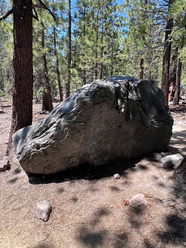
Erratic boulder thrown by the 1915 eruption


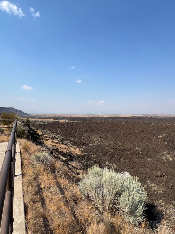
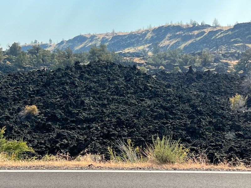
The Lava Beds National Monument, CA, gave us a sense of the immense scale of the huge shield volcanoes that dominated the area millions of years ago (the smoke from nearby forest fires made the scene even more dramatic). The two-mile loop road took us through the immense lava field created by the Medicine Lake shield volcano.  This site also included the battlefields of the Modoc War, including "Captain Jack's Stronghold" a favorite of Robinson Family lore.


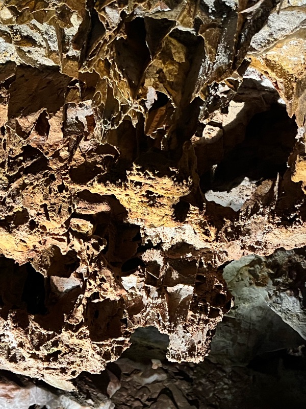
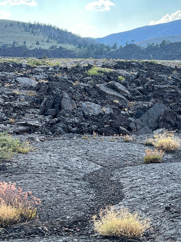
In Idaho, Craters of the Moon NM & Preserve, another large volcanic area focused on different types of of lava  - a’a and pahoey-hoey, traditional Hawaiian names used by geologists. The pahoey-hoey is smooth lava that looks like coils of rope or fabric, caused by very hot lava that forms a skin on top as it cools as the hotter lava flows beneath it dragging and wrinkling the “skin.” The a’a is jagged with sharp points, and results from cooler lava that breaks up as it flows. The other feature of the park is the cinder cones that follow the fault lines across a vast plain, one of which, covered in black gravel, was necessary to climb. This park also had a lot of lava tubes and caves - home to bats and other critters.


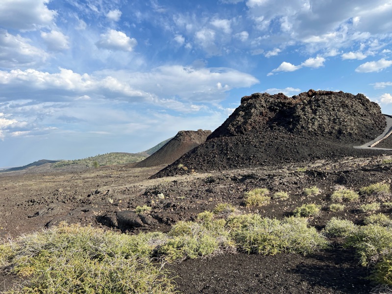
Cheryl waving from halfway up the cinder cone

Yellowstone NP, WY,(covered more extensively elsewhere) also featured bubbling sulfur baths, sulphur pools, steam vents and geysers, the famous “Old Faithful,” and other features that remind us that the crust of earth we live on gets very thin in spots, and there is in inferno of magma beneath us.


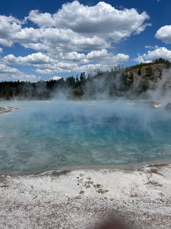
The polychromatic ponds at Yellowstone

Mongolia Day 15 & 16: Farewell to the Gobi and Mongolia

​ Today the Gobi Desert showed a different face entirely.  We had a lot of strong winds overnight, and in the morning it was blowing like cr...