WIND and WATER
While volcanoes and earthquakes throw up new features on the landscape, wind and water mold rock into fantastic shapes to create canyons, mesas, hoodoos, buttes, spires, and arches from the top down.
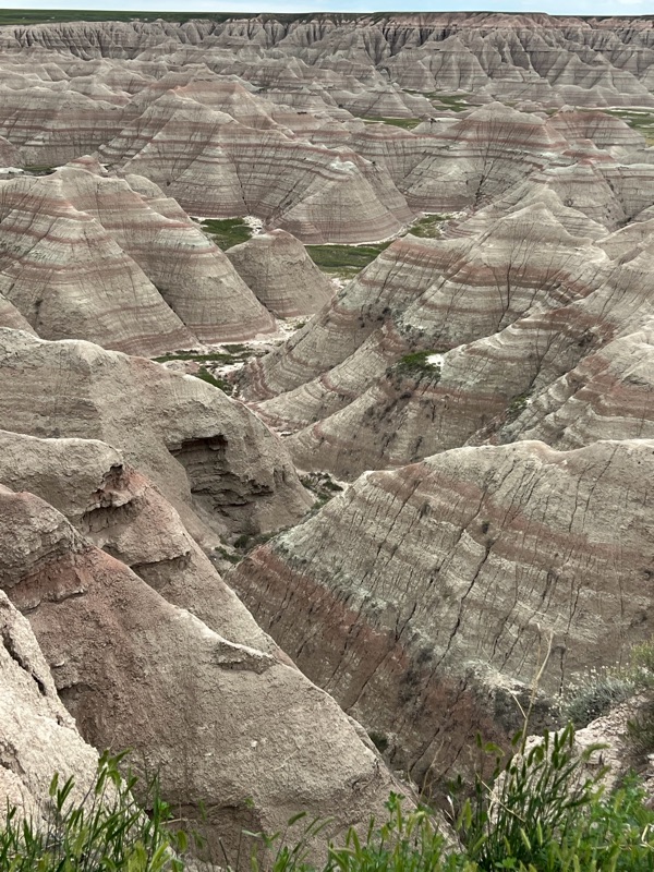
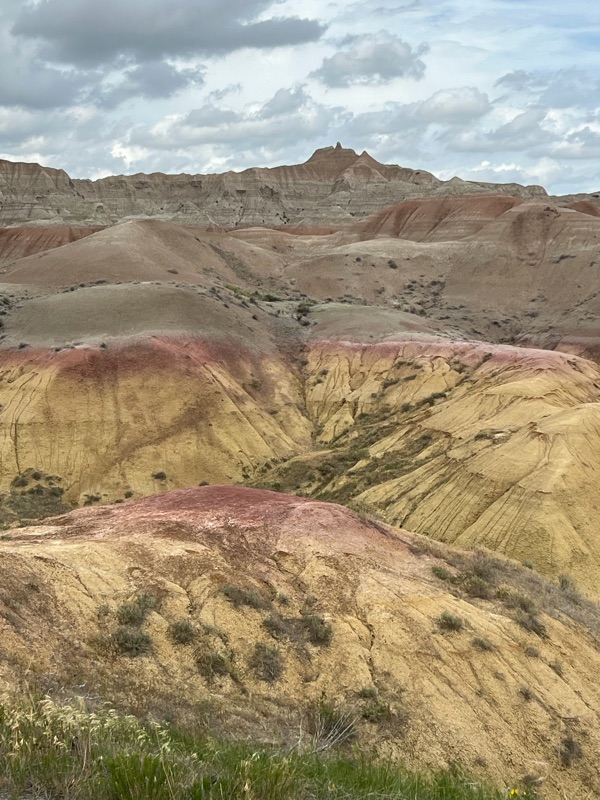
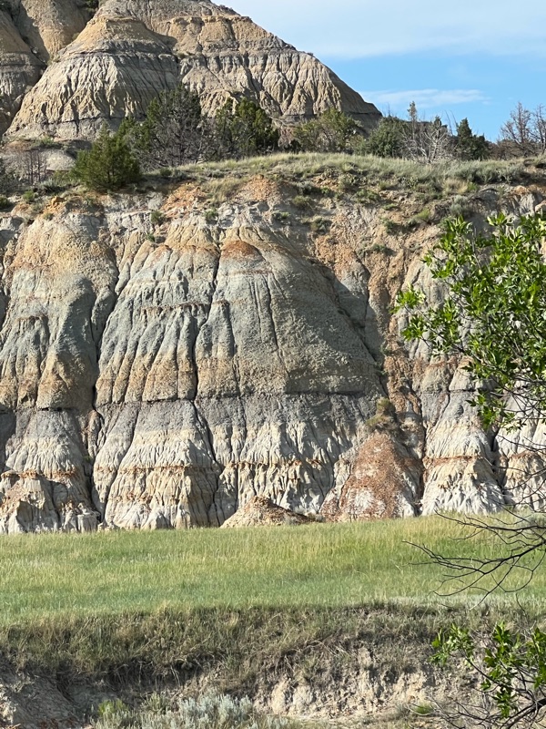
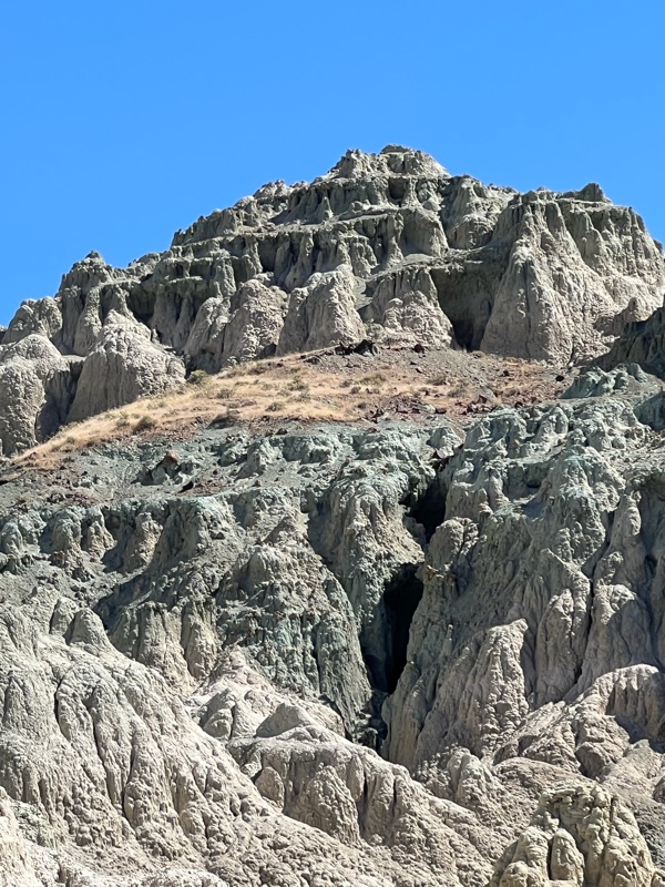
Badlands NP of SD and Theodore Roosevelt NP in ND are prime examples, where erosion has created many of these formations in spectacular colors. Standing on the prairies and looking down into the vast expanse of layered rock formations, and realizing the red, orange, yellow and grey layers were once swamps, rivers, forests, or seas that produced different minerals and fossils, left us in awe of the millions of years of changing climates and ecosystems that came before us and how very tiny our current existence is in geologic time. They are also astoundingly beautiful and another reminder of what currently exists beneath our feet.
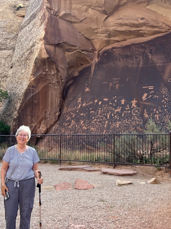
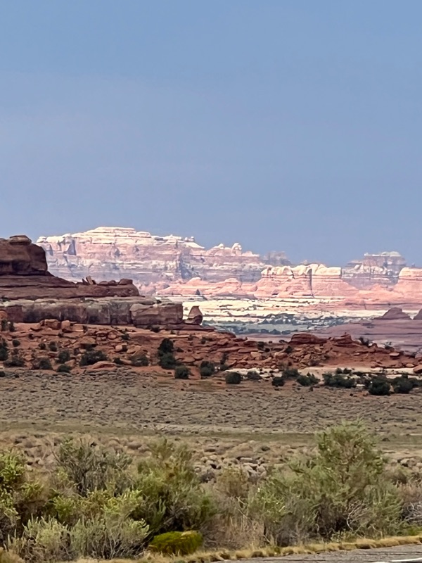
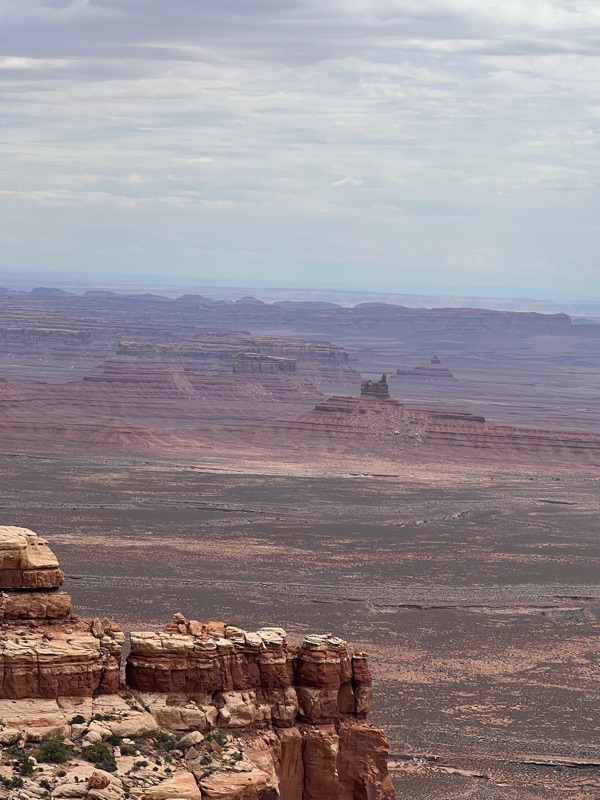
Canyonlands NP, UT is another impressive example of wind and water creating beautiful vistas of mesas buttes and spires. One interesting phenomena here was the sheer cliff faces covered with “desert varnish,” a black film of iron and manganese oxide and dust. We stopped at Newspaper Rock to view the many petroglyphs, some over 2,000 years old, carved into the blackened surface of the rock by ancient peoples as well as a few more modern travelers.
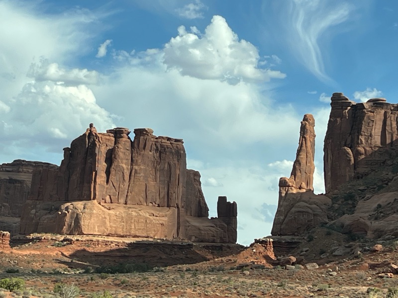
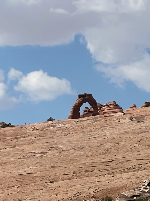
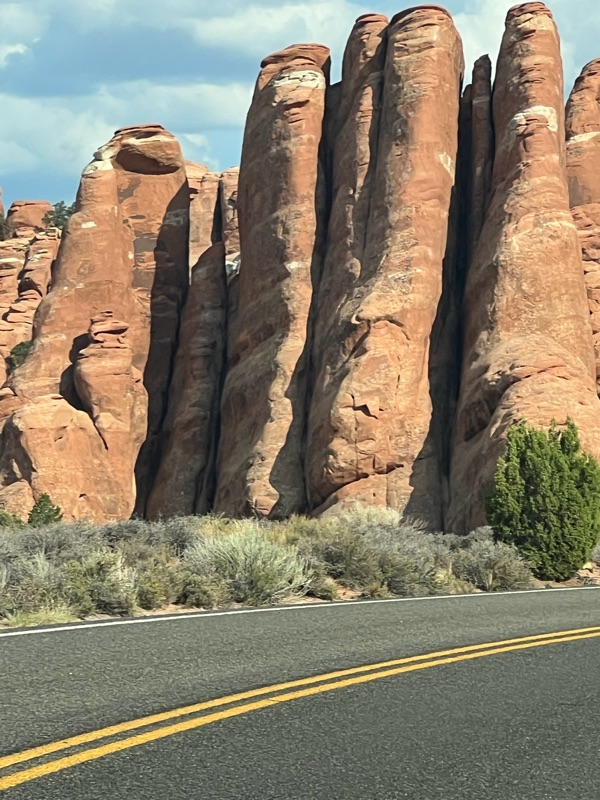
Arches NP, UT, was another graphic demonstration of the power of wind and water to shape the landscape. While the Delicate Arch is the most famous feature, the volume and variety of formations, including arches, bridges, hoodoos, spires an many more, are the real stars. The Park is full of an amazing array of wonderful red rock formations, created primarily by wind.
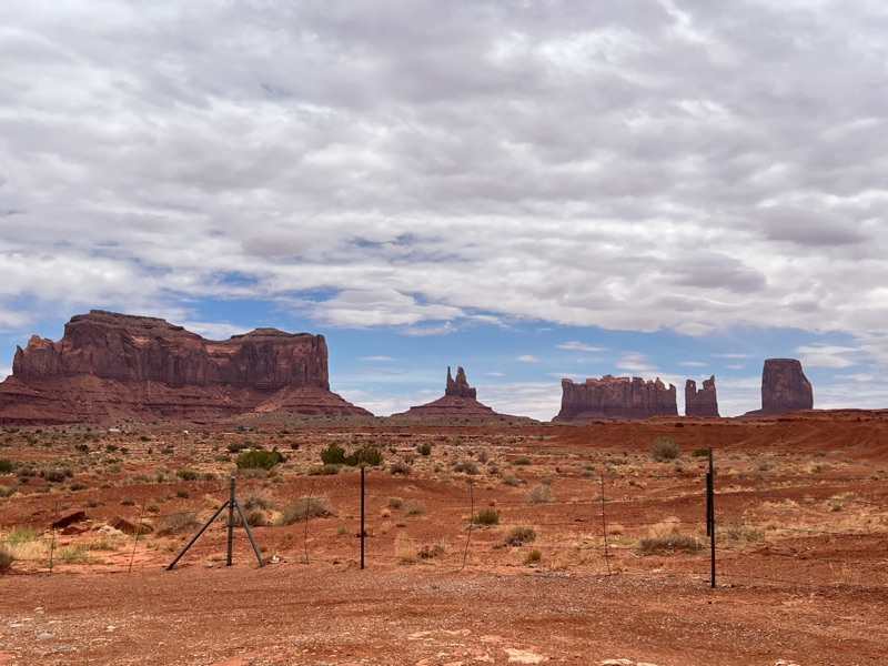
Monument Valley Navajo Tribal Park, in Navajo Nation lands located within Arizona, is noted for the “monumental” sandstone buttes, some as much as 1000 feet high, that rise up out of the desert. Because they are widely spaced, they are especially impressive. Even more impressive was the precipitous drive up and down the Moki Dugway, a narrow road that hugs the sheer edges of a huge butte, that was by far the best way to get to the Valley. (The word “moki” refers to a road that has been carved out of a hillside or cliff face.) Coming down the butte, we were treated to awesome views of the valley and the possibility of oblivion. Part of our experience was talking with Navajo women who were selling jewelry by the side of the road, and driving past many joggers who were re-enacting the scene from Forrest Gump, running along the same piece of road featured in the film.
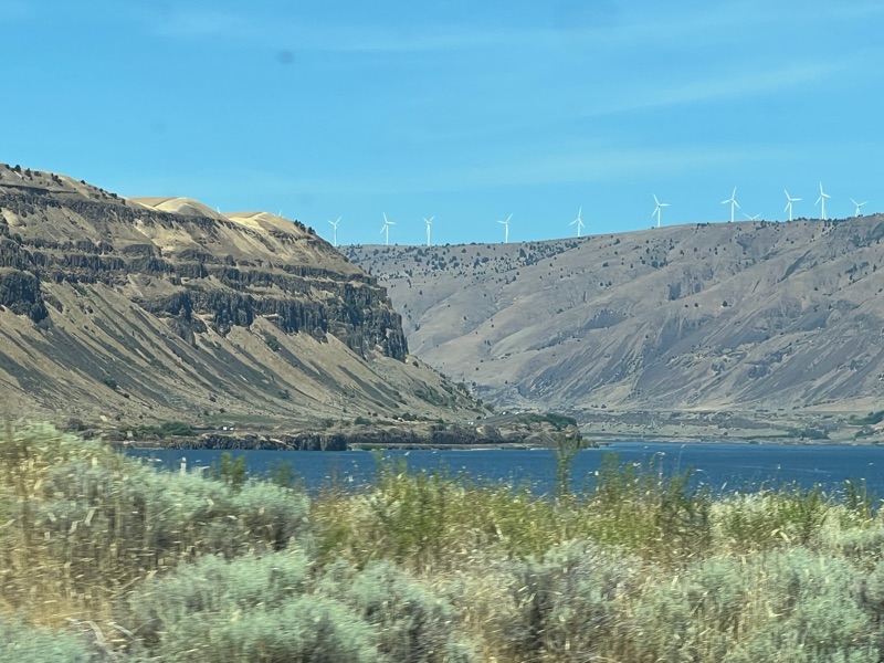
One of the most consequential examples of erosion occurred during the Ice Age Floods when a glacier that had created a natural dam on the ancient Lake Missoula in Montana melted. A wall of water, ice and debris several hundred feet high rushed across eastern Washington, gouged out the Columbia River Gorge, and dumped into the Pacific Ocean. This happened many times over the millenia as the climate warmed and cooled. At Palouse Falls, part of the Ice Age Floods National Geologic Trail, the river cascades 200 feet over the sheer sides of the canyon and continues west. The place is significant because it is the last active year-round waterfall along the Ice Age Flood path.
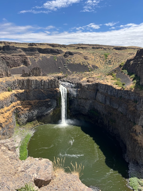
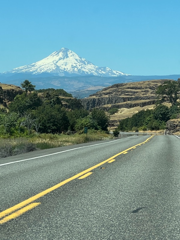
What is more impressive, though, is the huge Columbia River Gorge with its high basalt cliffs on both sides. The Gorge is about 80 miles long,from one to four miles wide (averaging 1.5 miles)and from the rim of the cliffs to the bottom of the river, about 4,000 feet deep in some places. Both the Falls and the Columbia Gorge are examples of the dramatic result that can be produced by incomprehensible volume of water, ice and debris pummeling through the countryside.

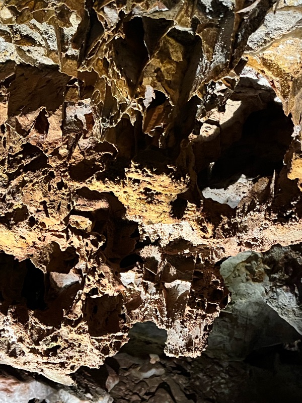
The effects of water on the earth are not all above ground. Slower crafting of fantastic shapes was visible in the slow dripping of minerals and water in the caves of the Black Hills in SD, where water eroded rock over millennia at Wind Cave and Jewel Cave. These two caves are among the longest in the world and are still being explored to document even greater length. Such exploration is not for the claustrophobic, as it involves crawling on your belly through very narrow passages. Both caves featured ranger-led tours that pointed out the various formations created by water flowing over and through rock.

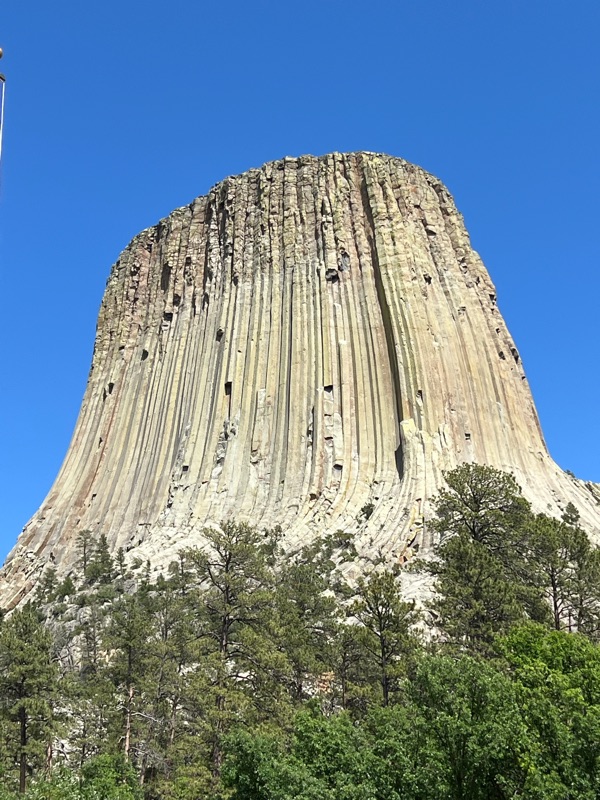
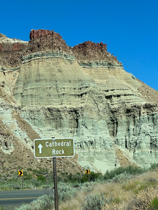
We saw other examples of the erosion of rock over time by water and wind at Devils tower, WY,
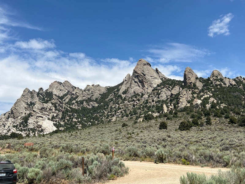
City of rocks, ID,
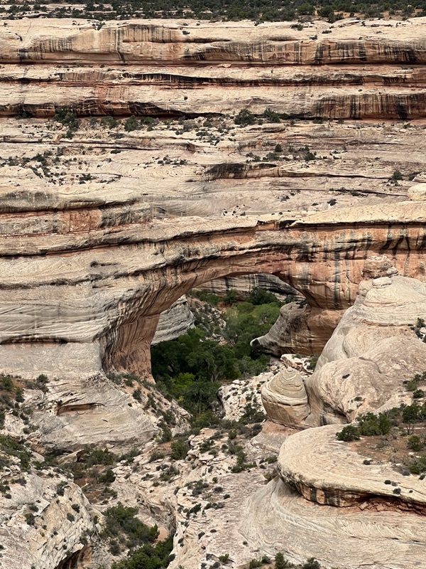
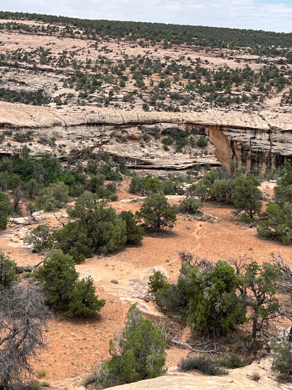
Natural bridges, UT
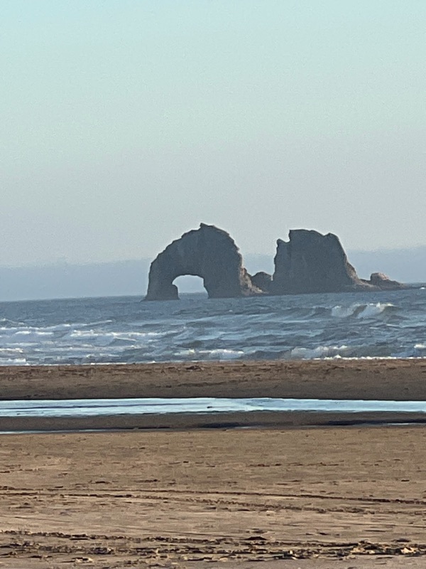
as well as the Oregon haystacks in the Pacific.
All these relentless forces of nature create much of the natural beauty of the earth, and inspire awe and appreciation for what we have and all that came before us. Each place inspired us to continue to seek more opportunities to learn more about our county and how it evolved over millions of years.


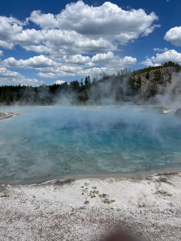 The polychromatic ponds at Yellowstone
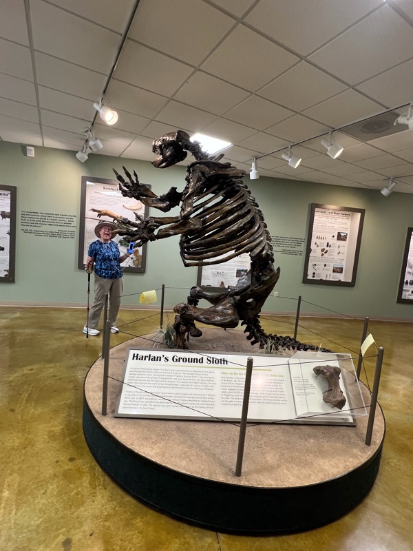 Ruth and the Giant Sloth